| Carnforth
is a
small town situated in the North West of England. Carnforth Railway Station
NGR
SD496 707
Longtitude 2 46' 16" W
Latitude 54 7' 47"
N West
Coast Railway / Steamtown / Carnforth 10A / LMSR / Furness Shed
NGR SD495 709
Longtitude 2
46' 22" W
Latitude 54 7' 53" N LNWR Shed
NGR
SD 493 705
Longtitude 2 46' 33" W
Latitude 54 7'
40" N
Midland Railway Shed
NGR
SD 502 710
Longtitude 2 45' 43" W
Latitude 54 7'
56" N Carnforth
F+M Station (first)
NGR
SD494713
Longtitude 2 46' 28" W
Latitude 54 8' 6" N
Carnforth F+M
Station (second)
NGR
SD498711
Longtitude 2 46' 6" W
Latitude 54 7' 59" N
Yealand Halt
(possible location)
NGR
SD513740
Longtitude 2 44' 45" W
Latitude 54 9' 33" N
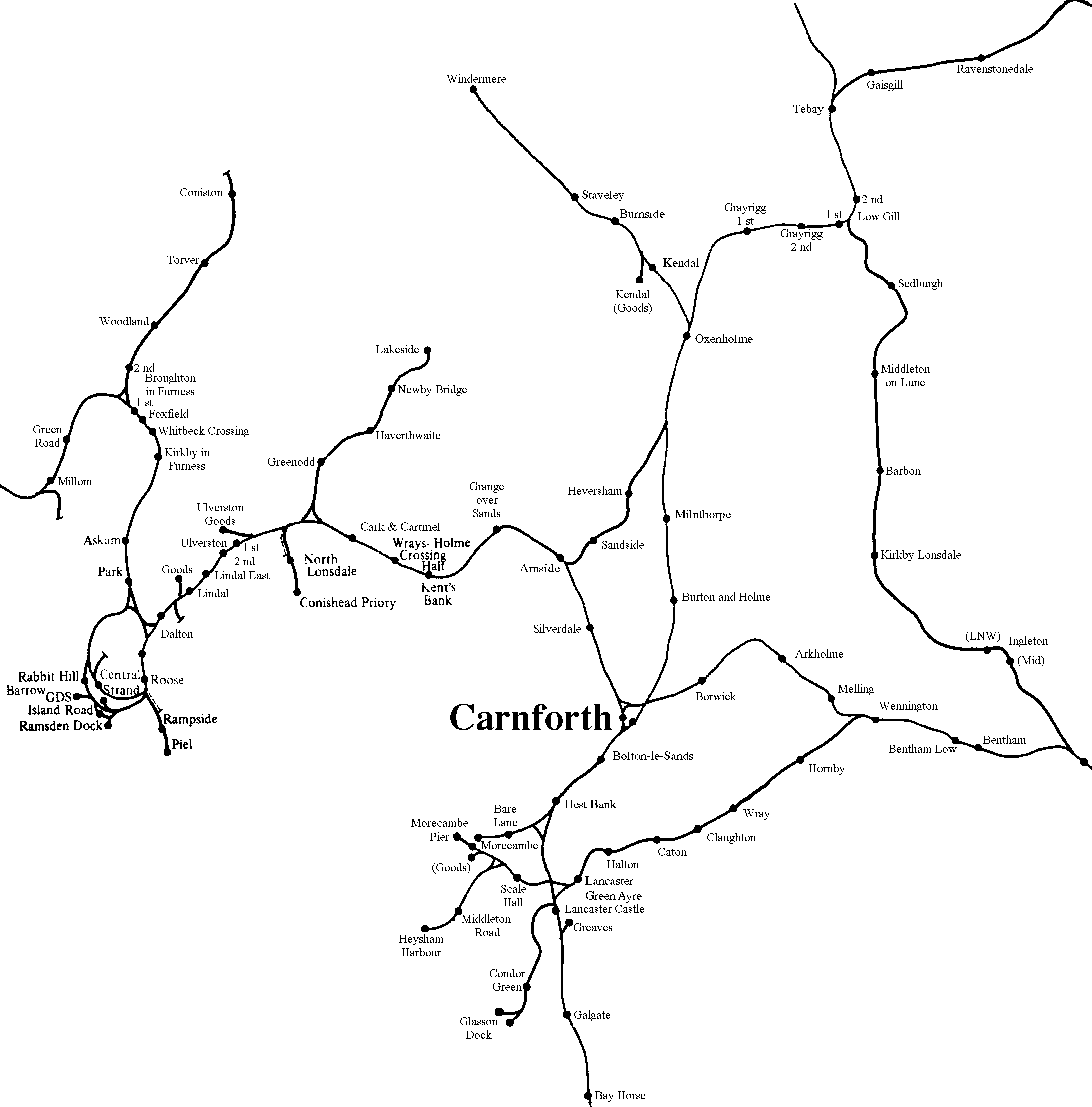
The map references are as close as I can get them, working
from a one inch to a mile, Ordnance Survey Map, of the area.

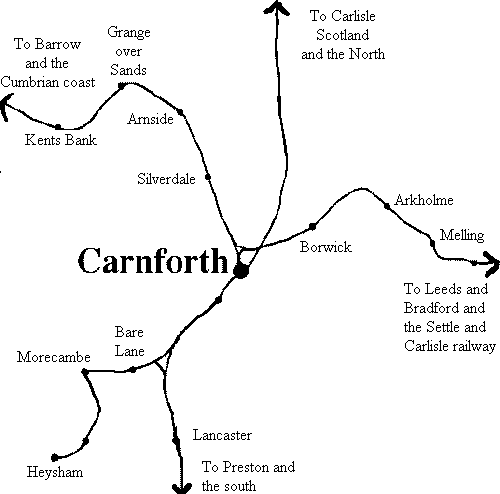
"All Time" railway map, of the North West of
England.
This map is NOT based upon a particular period, and so, not all the
Stations portrayed, may have been open at the same time. Many of the
Stations shown are now closed.
[
Top ] [ Home
] [ webmaster(at)carnforth-station.co.uk
]
http://www.carnforth-station.co.uk
|