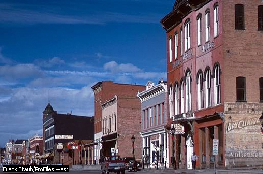
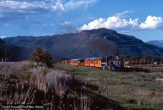
Colorado is the rectangle shaped
state in the western United States. The Rocky Mountains, form the
most dominant physical feature of the state. To the west of the
Rockies lie the high plateaus of the Colorado Plateau, and to the
east are the Great Plains. High, rugged mountains and plateaus occupy
fully two-thirds of the state, and make Colorado a state of striking
beauty. All of Colorado is more than 3300 feet above sea level. The
state, with an average elevation of about 6800 feet, is the highest
of all the states. 

The mountains and plateaus are rich in gold, silver, and other minerals and are the source of most of the state's water. The mountains have played a major role in the development of Colorado, most recently by attracting a steady flow of tourists, but they have also been a barrier to travel, communication, and settlement. Except for small cities and towns in the sheltered river valleys and mountain basins, most of western Colorado is sparsely populated.
In contrast, eastern Colorado has flat, treeless plains that extend from the Rockies to the Nebraska and Kansas state lines. Cultivated where there is sufficient moisture or irrigation, they consist of croplands and grasslands. On the plains just east of the Rockies is Denver, which is the state capital, the center of the state's largest metropolitan area, and a major city of the Western United States.
The state's name, Colorado, is a Spanish word meaning "reddish colored." It was the name early Spanish explorers gave to the Colorado River, which originates in the state. When Colorado became a territory in 1861, William Gilpin, the first territorial governor, formally requested that it be called by the old Spanish name. Colorado was admitted to statehood on August 1, 1876, during the 100th anniversary of the signing of the Declaration of Independence, and today its official nickname is the Centennial State.
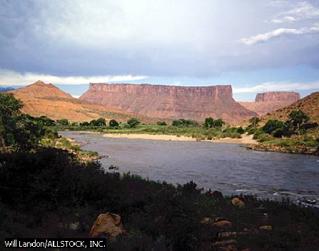 Famous
for its portion of the Rocky Mountains, the state of Colorado has
spectacular lowlands as well. The Colorado River, measuring 1450
miles in its entirety, has carved a number of deep canyons and gorges
along its path through the state.
PHYSICAL GEOGRAPHY
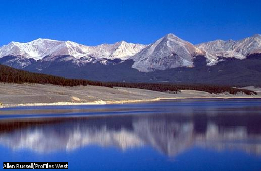
Colorado ranks eighth among the states in size. It has an area of 104,100 square miles, including 371 square miles of inland waters. The state is rectangular in shape, measuring 387 miles from east to west and 276 miles from north to south. Colorado straddles the Continental Divide, which separates rivers flowing to the Pacific Ocean and the Gulf of Mexico. In Colorado the lands west of the divide are referred to as the Western Slope, while those to the east are often called the Eastern Slope.
Natural Regions
Colorado includes parts of three major physical graphic areas of the western United States. They are, from east to west, the Great Plains, the Southern Rocky Mountains, and the Colorado Plateau. In addition, Colorado includes small sections of two other natural regions, the Wyoming, or Green River, Basin and the Rocky Mountains, which lie in the extreme northwest. Both of these regions are, like the Southern Rocky Mountains, part of the vast Rocky Mountain System.
The Great Plains,
a broad expanse of flat or rolling prairies that extend from Alberta
to Texas, cover the eastern third of Colorado. They rise gently from
about 4000 feet above sea level along the Kansas state line to about
7000 feet above sea level at the eastern foot of the Rocky Mountains.
The plains are used mainly for growing wheat and other crops and for
grazing cattle.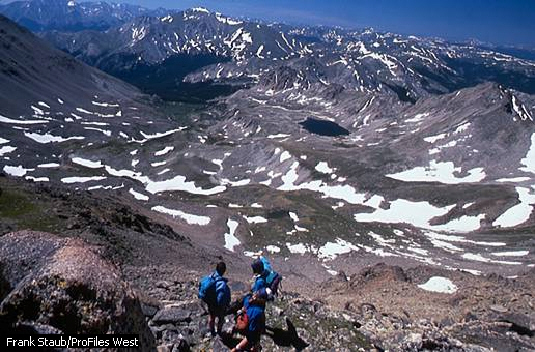
The physical features of the Great Plains are not uniform throughout the state. The plains are sometimes divided into three sections: the High Plains, the Colorado Piedmont, and the Raton section.
The High Plains, which include the most level land in the Great Plains, extend along the eastern border of Colorado. The only significant variations in relief occur where steep-sided river valleys, such as those of the Arkansas and Republican rivers, cross the plains or where there are shallow saucer like depressions.
The Colorado Piedmont, to the west of the High Plains, is more varied in relief, and many low ridges, steep bluffs, flat-topped mesas, and conical hills, called tepee buttes, rise above the surface. In the south the piedmont merges with the Raton section. The Raton section, more rugged than the Colorado Piedmont, includes numerous mesas and buttes of volcanic origin and narrow, rocky canyons.
 The
Southern Rocky Mountains occupy most of central Colorado
and extend in a north-south direction across the state. In Colorado
the Rockies are between 75 and 175 miles wide and include 53 peaks
that are more than 14,000 feet in elevation.
The mountains do not form a single highland area but are divided into two roughly parallel groups, or belts, of ranges. Several broad, high-altitude valleys and mountain basins separate the mountain belts from each other.
The eastern mountain belt
includes the Laramie Mountains, the Front Range, and part of the
Sangre de Cristo Mountains. The highest peaks of these eastern ranges
are Blanca Peak,  Longs
Peak, and Mount Evans, all of which are more than 14,250 feet high.
Pikes Peak, a conspicuous landmark at the southern end of the Front
Range, rises to 14,110 feet. Arapaho Glacier, in the Front Range, is
the largest glacier in the Southern Rocky Mountains.
In Colorado the Continental Divide, or Great Divide, follows the crest of the eastern mountain belt as far south as Mount Evans, then crosses over to the western belt and continues southward. The western belt of high mountains includes the Park Range, the Sawatch Range, and the San Juan Mountains. The Sawatch Range contains Mount Elbert, the state's highest peak at 14,433 feet. The Sawatch Range and the San Juan Mountains combined contain 27 of the state's mountains over 14,000 feet. The parks and valleys between the two mountain belts of the Southern Rockies are broad, relatively flat, grass-covered areas. The principal ones are, from north to south, North Park, Middle Park, South Park, and the San Luis Valley. Spur ranges of the mountain belts that flank them separate them from each other. They vary from about 6000 to 9000 feet above sea level.
The Colorado Plateau occupies most of western Colorado. It is made up of dozens of separate plateaus that range from about 5000 to 11,000 feet high and are arranged in seemingly haphazard tiers and groups. Many are separated or cut by deep canyons. Tributaries of the Colorado River, such as the Gunnison River, formed most of the canyons. Rugged hills and a few mountain ranges rise from the Colorado Plateau.
Rivers and Lakes
Although the rivers of Colorado are navigable only by small boats, they are important as a source of irrigation water for use in Colorado and adjoining states. However, the water level of the rivers fluctuates seasonally and from year to year. The level is generally low in winter and high in spring and summer, during the runoff of melted snow from the mountains.
Colorado has no large lakes of natural origin, but there are numerous small lakes in the mountains. The largest bodies of water in Colorado are the large reservoirs created by dams and used for irrigation and flood control. Among the largest are John Martin, Granby, Pueblo, and Blue Mesa reservoirs.
Plant Life
Forests cover about one-quarter
of Colorado. Most of the forests are located in the Rocky Mountains below 11,500 feet and in the wetter sections of the
Colorado Plateau. Among the trees common to Colorado are the conifer
species of cedar, spruce, fir, and pine. Different species of trees
are found at different altitudes. The ponderosa pine, which is
economically the state's most valuable timber tree, grows on the
lower mountain slopes. The blue spruce, the state tree, grows on
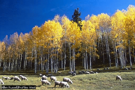
the higher slopes. The quaking aspen, a deciduous tree, is found
in scattered groves up to the timberline. The Great Plains region is
almost treeless, except for certain areas that contain peach leaf
willow and cottonwood trees.
Natural grasslands once covered
most of Colorado's plains but are now limited to those areas that are
not cultivated. Buffalo grass and blue grama are the most common
grasses, and they produce a continuous sod covering. In the driest
sections of the plains bunch grasses 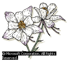 such
as Western wheatgrass, Indian ricegrass, and needlegrass grow in
tufts or patches and are sometimes interspersed with sagebrush,
cactus, and other plants. Natural grasslands are also found high in
the mountains, above the timberline.
Wild flowers of many different kinds grow in Colorado. In spring and early summer the sand lily, parry's primrose, and other flowers provide splashes of color against the somber brown of the plains, and the mariposa lily, wallflower, purple fringe, and larkspur flourish on the low mountain slopes. At higher elevations, in the shade of aspen groves, grows the Rocky Mountain columbine, which is the official state flower. Above the timberline, species of tiny colorful flowers appear as soon as the snow melts. In summer, skypilot and old man of the mountain dot the high alpine landscape. In the driest parts of Colorado, particularly on the Colorado Plateau, several species of drought-resistant yucca (Spanish bayonet) and cactus produce spectacular flowers.
Animal Life
Millions of pronghorn and bison (popularly called buffalo) roamed the plains and parks of Colorado before the species were hunted nearly to extinction. Today only small herds of bison remain on private land, although herds of wild pronghorn have recovered and are again common throughout the state. On the plains, small mammals, such as the skunk, ground squirrel, and prairie dog, are numerous, as is the larger coyote. Among the many animals found in the mountains are the black bear, moose, red fox, gray fox, bobcat, porcupine, marten, beaver, and mule deer. The bighorn sheep, which is the state animal, is found in the Rockies, where mountain lion populations have been increasing in recent years.
There are many species of birds,
both migrant and resident, in Colorado. They range from the golden
eagle, which lives on high rock  outcrops
throughout the state, to the western mockingbird, red-winged
blackbird, western meadowlark, and robin, which are common on the
plains. Game birds, such as species of grouse, quail, pheasants,
ducks, turkeys, and geese, are also plentiful. Birds common to
cultivated areas include the sparrow, the blackbird, and the
yellowthroat and other warblers. The lark bunting, the state bird,
is found throughout much of the state but is more common on the
eastern plains than elsewhere.
Fish in Colorado's lakes and streams include carp, perch, bass, catfish, walleye, sunfish, and the kokanee salmon. Several kinds of trout, which live in cold mountain streams, are the state's most popular game fish. Turtles, lizards, snakes, and other reptiles are found throughout the state, while the boreal toad and tiger salamander live in the high mountain areas. There is only one common poisonous species of snake in Colorado: the western rattlesnake, which is native to the plains.
RECREATION AND PLACES OF INTEREST
As a vacation state, Colorado has few rivals. Superb scenery, a wealth of historic sites, and excellent hunting, fishing, and skiing facilities and opportunities combine to attract visitors at all seasons.
National Parks
 The
Cliff Palace in Mesa Verde National Park, located in southwest
Colorado, was built by the ancestors of the Pueblo peoples. The
cliffs provided shelter from harsh weather conditions and enemies.
The
Cliff Palace in Mesa Verde National Park, located in southwest
Colorado, was built by the ancestors of the Pueblo peoples. The
cliffs provided shelter from harsh weather conditions and enemies.Rocky Mountain National Park includes some of the highest, most spectacular, and rugged mountains in Colorado. In the park are Longs Peak, at 14,255 feet above sea level, and many other peaks. Wildlife is abundant throughout the park. Mesa Verde National Park in southwestern Colorado contains ruins of Anasazi pit houses, pueblos, and cliff dwellings, which are considered some of the best-preserved in the country.
One of the most spectacular tourist attractions is the Black Canyon of the Gunnison National Monument, which contains the narrow gorge cut by the Gunnison River. Colorado National Monument, near Fruita, features deep gorges and huge solitary rock formations, such as the 500 foot Independence Rock. Dinosaur National Monument, which is located on the Utah-Colorado border, is famous for fossilized remains of dinosaurs and other prehistoric animals. Great Sand Dunes National Monument, near Alamosa, contains some of the largest and highest sand dunes in North America. Hovenweep National Monument, which is in both Utah and Colorado, has ruins of many Native American cliff dwellings and other structures. Also in the southwest is Yucca House National Monument. It contains the ruins of an ancient pueblo yet to be excavated by archaeologists and is not open to the public. In southeastern Colorado is Bent's Old Fort National Historic Site, a reconstruction of the first American settlement in Colorado. A rich deposit of fossil plants and insects gives a detailed look at life in ancient North America at Florissant Fossil Beds National Monument, west of Colorado Springs. Curecanti National Recreation Area has fine recreational facilities centering around reservoirs.
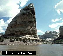
 Steamboat
Rock, part of Echo Park in Dinosaur National Monument, marks the
place where the Yampa and Green rivers meet in northwestern Colorado.
National Forests
There are 11 national forests (and part of a 12th) in Colorado. In Rio Grande National Forest are several active mining camps and also vast wilderness sections. In Roosevelt National Forest are Arapaho Glacier and the deep canyons of the Big Thompson, Boulder, Cache la Poudre, and St. Vrain rivers. Routt National Forest includes sections of the Continental Divide above the timberline. In San Isabel National Forest, near Pueblo, are dude ranches and scenic motor drives. San Juan National Forest is the largest national forest, covering more than 800,000 hectares (2 million acres). Manti-LaSal National Forest is shared with Utah. The Arapaho National Forest, established by President Theodore Roosevelt, is named after the Plains people who frequented the region for summer hunting. The forest includes land on both sides of the Continental Divide, which separates the Platte River watersheds that flow toward the Gulf of Mexico and the Colorado River watersheds that flow toward the Pacific Ocean. The White River National Forest is one of the largest and oldest national forests in the Rocky Mountains. Its national popularity is growing because of the many opportunities for recreation. The Uncompahgre National Forest contains primitive routes to old mining operations that are now popular with off-road vehicle drivers. Grand Mesa National Forest contains Grand Mesa, one of the largest flat-top mountains in the world, which boasts hundreds of small lakes and a reputation for excellent fishing. Gunnison National Forest contains many areas popular with backcountry enthusiasts. Pike National Forest features the famous Pikes Peak, the top of which can be reached by a scenic toll road.
