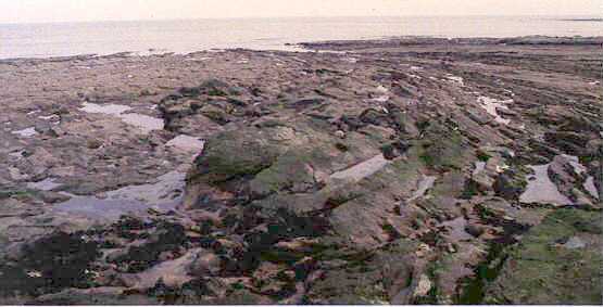
The rocks show remarkable features resulting from the formation of point bars in meandering channels, channel infill and other structures.

Foreshore at Cowlam Hole
At first this looks like an anticline similar to that displayed on the foreshore at Robins Hoood Bay. Closer analysis shows that the strata are pretty much level, it is current bedding that gives the miniature 'dip and scarp'topography. In the cliff section are a whole series of small sand filled channels. Some are choked with coalified remains of tree trunks and other vegetation. What you are seeing accumulated as a series of point bars laid down as the meander of a river channel migrated.
Idealised diagram of fluvial environment.
The photograph shows a meander belt making a spectacular 180o sweep
across the wave cut platform. Trough cross bedding within the chutes shows that the
current flow was clockwise (right to left in the picture)
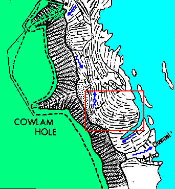
The red box shows approximately the area of the photograph
Location map showing details of the paleo-channel. The approximate area of
the photo is outlinesd in red.

Blue arrows show paleocurrent direction.