
![]()
![]()
 SUGGESTIONS
![]()
|
|
CHAMELEON ORIGINS and DISTRIBUTION PAGESMAPS of AFRICA
|
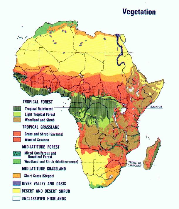
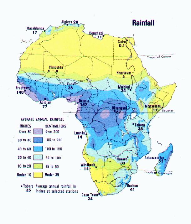
| VEGETATION | RAINFALL |
|
|
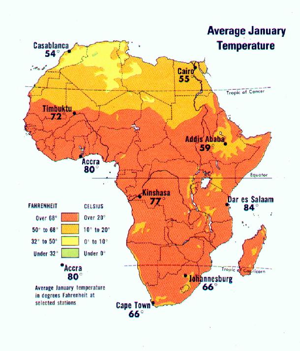
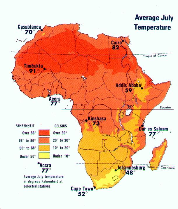
| TEMPERATURES JANUARY | TEMPERATURES JULY |
|
|
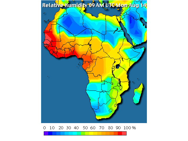
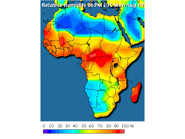
| RELATIVE HUMIDITY AUGUST AM (Eastern) | RELATIVE HUMIDITY AUGUST PM (Eastern) |
|
|
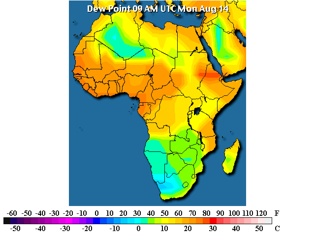
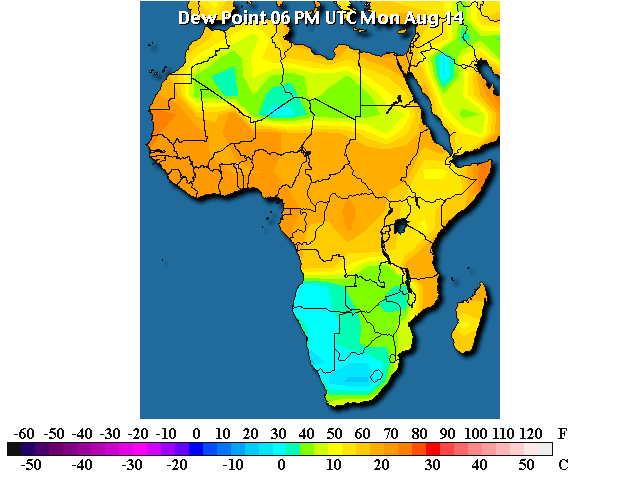
| DEW POINT AUGUST AM (Eastern) | DEW POINT AUGUST PM (Eastern) |
|
|
To watch the temperature and humidity change as the day passes
| This site can in no way be reproduced or copied without the expressed written permission of David Pickering. I have given credit where the author is known. If I have used any material without your permission or without the proper credit please inform me and it will be corrected.Copyright©2000 David Pickering. |